
Archive Record
Images
Metadata
Catalog Number |
2003.31.1 |
Object Name |
Map |
Scope & Content |
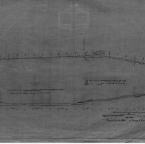
Map of the vertical and horizontal portions of Paper Mill Road near the Salem and Lowell Railroad near Crystal Lake. This was also known as Phelps Mill area. This is a duplicate of the orginal. It is unknown what happened to the original. The land was surveyed by Charles A. Putnam in April of 1882. The map was traced from the original by George A. Barnaby in March of 1928. One 28 x 18" Starched Linen Map. |
Access Conditions |
Restricted to use in Sutton Room or Research Room. |
Physical characteristics |
Starched Linen. |
Creator |
George A. Barnaby |
Title |
Profile Of a Portion of the Paper Mill Road at West Peabody. |
Level of description |
Item |
Copyrights |
All copyrights belong to the Peabody Institute Library |
Collection |
Local History Resource Center |
Pub Date |
1882 |
Size |
28 x 18" |
Subjects |
Peabody (Mass.)--History--Map(s) |
Parent ObjectID |
2015.36.2 |