
Archive Record
Images
Metadata
Catalog Number |
2016.13.1 |
Object Name |
Map |
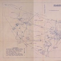
Scope & Content |
A partial map of Peabody. it is unknown when the map was created. The map does have a legend that includes symbols. They include: U.S.C. & G.S. and State Triangulation Station Local Conrol Survey Triangulation Station L.C.S Traverse Station (Standard Disk) L.C.S Traverse Station (Semi-Permanent) U.S.C. & G.S. Bench Mark Local Control Survey Bench mark Local Control Survey Tempoary Bench Mark |
Access Conditions |
Restricted to use in Sutton Room or Research Room. |
Creator |
Unknown |
Title |
Map of Peabody |
Level of description |
Item |
Copyrights |
All copyrights belong to the Peabody Institute Library, Peabody, MA |
Collection |
Local History Resource Center |
Pub Date |
No Date |
Size |
31.7 x 28.2 cm |
Subjects |
Peabody (Mass.)--History--Map(s) |
Parent ObjectID |
2015.36.2 |