
Archive Record
Images
Metadata
Catalog Number |
2017.42.1.B |
Object Name |
Map |
Scope & Content |
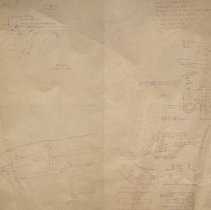
A plan that shows a proposed 16 inch water line on Winona Street in Peabody. The date on the plan id February 1984 and was drawn by the City of Peabody Department of Power and Sewer. The Director was John H. Seites, P.E. The plan shows both the elevation and top down map view. There is a profile for both. The section of Winona Street where the proposed water line would go is near Devils Dishfull Pond and streets include: the intersection of Lake Street, Pine Street and Donegal Road. |
Access Conditions |
Restricted to use in Sutton Room or Research Room. |
Creator |
John H. Seites, P.E. |
Title |
Plan Showing Proposed 16 Inch Water Line Winona Street |
Level of description |
Item |
Copyrights |
NO COPYRIGHT - UNITED STATES The organization that has made the Item available believes that the Item is in the Public Domain under the laws of the United States, but a determination was not made as to its copyright status under the copyright laws of other countries. The Item may not be in the Public Domain under the laws of other countries. Please refer to the organization that has made the Item available for more information. NOTICES Unless expressly stated otherwise, the organization that has made this Item available makes no warranties about the Item and cannot guarantee the accuracy of this Rights Statement. You are responsible for your own use. You may find additional information about the copyright status of the Item on the website of the organization that has made the Item available. You may need to obtain other permissions for your intended use. For example, other rights such as publicity, privacy or moral rights may limit how you may use the material. |
Collection |
Map Collection |
Pub Date |
1984 |
Size |
61 x 91.7 cm |
Subjects |
Peabody (Mass.) Peabody (Mass.)--Department of Public Service Peabody (Mass.)-- Politics and government Peabody (Mass.)--Water & Sewer |
Parent ObjectID |
2015.36.2 |