
Archive Record
Images
Metadata
Catalog Number |
2003.356.1 |
Object Name |
Map |
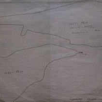
Scope & Content |
Map of Cedar Pond that shows the inlet and outlet. There is little detail on the map. The map does say that the area is 12.07 acres and includes the traverse run on ice. It is unknown the location of the original. The map was drawn by C.A.L. in February of 1913 and was later traced by George A. Barnaby in December of 1928. Plan No. 179 |
Access Conditions |
Restricted to use in Sutton Room or Research Room. |
Physical characteristics |
Starched Linen Map |
Creator |
C. A. L. |
Other Creators |
George A. Barnaby |
Title |
Cedar Pond |
Level of description |
Item |
Copyrights |
All copyrights belong to the Peabody Institute Library, Peabody, MA |
Collection |
Local History Resource Center |
Pub Date |
1913 |
Size |
18" x 28" / 46 x 71.12 cm |
Subjects |
Peabody (Mass.)--History--Map(s) |
Parent ObjectID |
2015.36.2 |