
Archive Record
Images
Metadata
Catalog Number |
2003.298.1 |
Object Name |
Map |
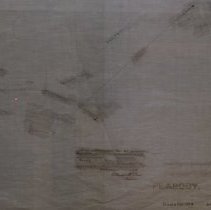
Scope & Content |
Location of underground conduits placed by N. E. Telephone and Telegraph Company in Peabody. This is a duplicate of the orginal. It is unknown what happened to the original. The land was surveyed by the New England Telephone and Telegraph Company in 1922. The map was traced from the original by George A. Barnaby in December of 1928. Plan No. 166 Sheet No. 1 Note Total Sheets 4 |
Access Conditions |
Restricted to use in Sutton Room or Research Room. |
Physical characteristics |
Starched Linen Map |
Creator |
George A. Barnaby |
Title |
New England Telephone and Telegraph Co. of Massachusetts Locations of Underground Conduits in Peabody, Mass. |
Level of description |
Item |
Copyrights |
All copyrights belong to the Peabody Institute Library, Peabody, MA |
Collection |
Local History Resource Center |
Pub Date |
1922 |
Size |
18" x 28" |
Subjects |
Peabody (Mass.)--History--Map(s) |
Parent ObjectID |
2015.36.2 |
Relation |
Show Related Records... |