
Archive Record
Images
Metadata
Catalog Number |
2003.101.1 |
Object Name |
Map |
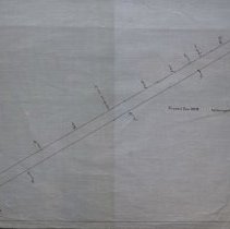
Scope & Content |
Road between Tremont Street and Walnut Street. The proposed road on map is present day Mount Vernon Street. In addition, Grove Street on map was renamed and is currently called Howley Street. This is a duplicate of the orginal. It is unknown what happened to the original. The map was traced from the original by George A. Barnaby in December of 1928. One 28 x 18" Starched Linen Map. Plan No. 70 |
Access Conditions |
Restricted to use in Sutton Room. |
Physical characteristics |
Starched Linen Map |
Creator |
George A. Barnaby |
Title |
Road between Tremont And Walnut Streets. |
Level of description |
Item |
Copyrights |
All copyrights belong to the Peabody Institute Library |
Collection |
Local History Resource Center |
Size |
28 x 18" |
Parent ObjectID |
2015.36.2 |